
Map interface changelog
Releases of the map interface, newest first. Since version 5.0 the map is one page of the unified Macrostrat website, and changes that affect the whole site are recorded in the website changelog; the entries below cover the map interface itself. The usage guide describes the features these releases introduced.
Version 4.2.0
August 25, 2023 · development release
- Switched Webpack compilation to Vite
- Experimental paleogeographic map interface
- Experimental ability to focus on a map source
- Info panel fixes
- Shift+Click to construct cross sections
- Allow cross-sections to be linked to externally (example: Kaibab Arch)
Version 4.1.3
February 4, 2023
Fix poor sequencing of API calls to improve info panel loading times.
Version 4.1.2
February 3, 2023
- Address bug where the wrong map information was shown (#75)
- Address bug that caused regional stratigraphy and fossil data to not appear in the info panel (#76)
- Refactored PBDB layer to work with new filter system
- Refactored column info loading to simplify logic
- Small improvements to performance
Version 4.1.1
February 2, 2023
- Fix navigation to some menu panels
- Allow linking to experimental line symbols as a normal map layer
- Include a notice that line symbols are enabled to the filter panel
Version 4.1.0
February 1, 2023
User interface improvements
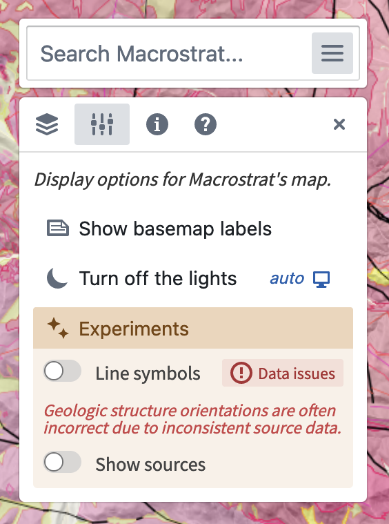
- Added a new Settings panel to control map display options. The Experiments sub-panel allows previews of new features that are still in development.
- Added a Dark mode for the entire user interface, including a new map style. This follows the browser-level preference by default, but it can be overridden from the Settings panel.
Map features and bug fixes
- Added an option to show and hide text labels on the map (in the Settings panel)
- Added a scale bar
- Moved the User location control to the bottom right corner of the map panel
- Improved the visual quality of hillshades when 3D terrain is enabled
- Decoupled location marker sizing and visual design from map style
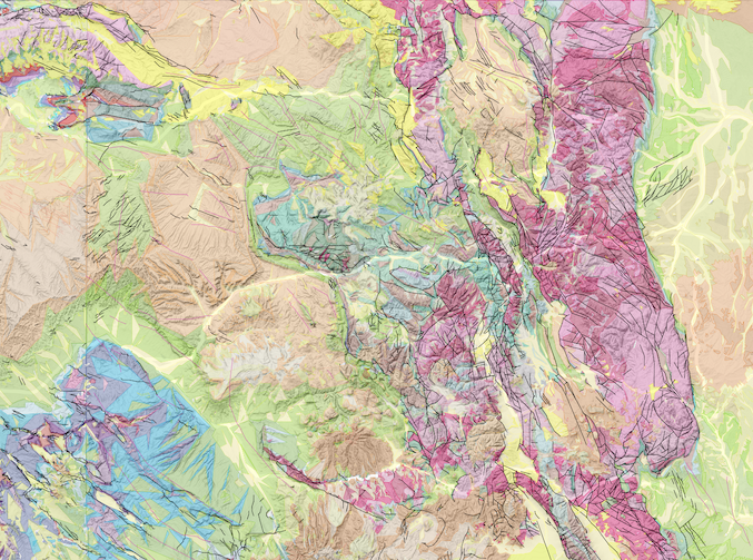
- Added an experimental Map sources layer (not yet fully integrated into the user interface)
Info panel

- Update xDD publications list to use the newer snippets API.
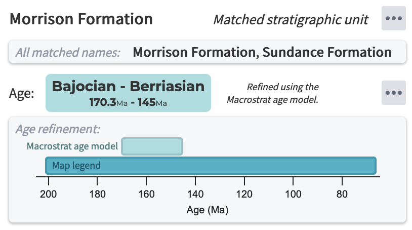
- Added an Age refinement panel to show relative age precision improvement using the Macrostrat age model.
- Add buttons in the header to recenter the currently selected map location and to copy the location permalink to the clipboard.
Line symbols (experimental)
Line symbols are critical to the representation of crustal processes on geologic maps.
In the Experiments panel, we have added a toggle for Line symbols, which enables a new rendering system for fault ticks and fold axes. This is an exciting advance that greatly increases the legibility and information density of the geologic map to align with printed products. Although the graphical style is nearly complete, data inconsistencies block us from enabling this feature broadly at the moment. Many source GIS datasets (especially older ones) do not record consistent orientation of faults and folds that allow symbology to be reconstructed. We must develop a strategy for correcting these data. As we embark on this process, we will begin making this system "live" on a map-by-map basis.
Location and filter state saving
- The focused location and info box can be loaded from URL parameters, allowing
map locations to be easily shared. Optional hash parameters set view
orientation, layer, and map filter state. The URL signature is
https://macrostrat.org/map/loc/<lon>/<lat>#<hash>. - Correctly save filter states from URL parameters.
- Major simplification of the internal design of the map filter system.
Examples of saved state
- Black Canyon of the Gunnison, oblique satellite view
- Vishnu Schist in the Grand Canyon, oblique view
- Mesozoic igneous rocks of California, overhead view with labels hidden
Internal improvements
- Yarn "Plug-n-Play" for quicker and more repeatable compilation
- Updated key dependencies, including Webpack, Mapbox GL JS, React, and BlueprintJS.
- Numerous updates to Macrostrat shared web components.
- Decoupled interactions in the map view, and moved more components to the
@macrostrat/mapbox-reactand@macrostrat/mapbox-utilsshared libraries. - Routing improvements in anticipation of adding non-map pages to the application.
Version 4.0.0
July 6, 2022
The 4.0 series represents the first major update to the Macrostrat web interface since 2018. It is the first major version of Macrostrat's web visualization components that is an evolution of the codebase rather than a complete rewrite. The 4.0 milestone simplifies, modernizes, and modularizes this application to allow a more collaborative development process.
Future iterations in the 4.0 series will add functionality such as stratigraphic columns, paleogeography, geochemical data holdings, and more.
This update was produced by Macrostrat technical lead Daven Quinn and research software engineer Casey Idzikowski.
User-facing changes
- Add a globe-based map projection and an oblique map view with 3D terrain (thanks Mapbox!)
- Removed Material UI in favor of Blueprint
- Make panels simpler and more information-dense
- Store oblique camera positions in hash string
- Numerous bug fixes for filtering map data
- In the info panel, expand all sections by default, and improve scrolling through them
Internal changes
- Convert codebase to TypeScript from JavaScript
- Start converting JSX to hyperscript
- Update React code to use functional components and hooks
- Improve handling of query strings
- Much better state management system and more consistent action handling

